- Plans tarifaires
- Favori
- Aide
-
 French
-
French
Parrot believes that drones are useful for everyday business. They must be easy to use and adaptable to complex missions.
Parrot believes that drones are useful for everyday business. They must be easy to use and adaptable to complex missions.
Cybersecurity by Design
No data shared by default
Strong authentication for 4G
FIPS140-2 compliant and CC EAL5+ certified Secure Elements
4G: Internet connectivity
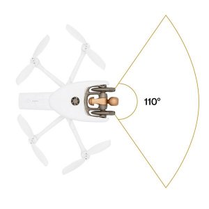
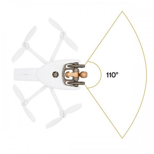
Connected without range limit Flies Beyond Visual Line Of Sight Worldwide compatibility
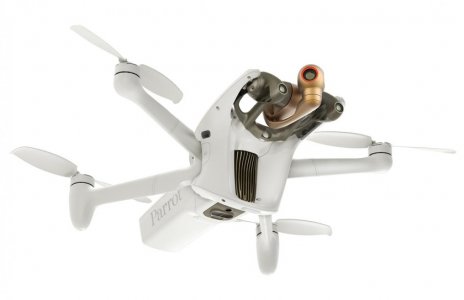
48 MP Camera
4K 60 fps: Smooth video
HDR10: Realistic colors
14 EV: Dynamic range
6x zoom: 1 cm details at 75 m (240 ft)
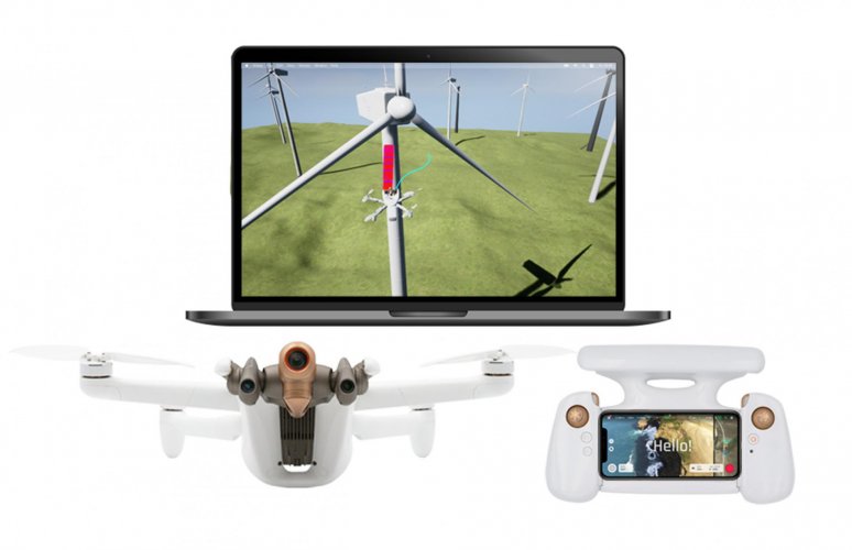
Autonomous Photogrammetry
Shoots 48 MP at 1 fps
Survey grade accuracy: 0.46 cm/px GSD at 30 m (100 ft) Embedded PIX4D flight planning
4G transfer to PIX4Dcloud
A Unique Robotic Platform
Software Development Kit with onboard coding capabilities Full open-source App
The largest Partner Ecosystem for Drones
COMPATIBLE THIRD-PARTY SOFTWARE SUITE
PIX4Dscan, PIX4Dinspect, PIX4Dcloud, PIX4Dreact, PIX4Dsurvey
APPLICATIONS
Inspection: buildings, infrastructures, telecom towers, wind turbines, solar panels, pipe- lines, refineries. Photogrammetry: mapping, surveying, 3D modeling, orthophotography. Construction monitoring, automated surveillance, real estate, insurance, video creation.
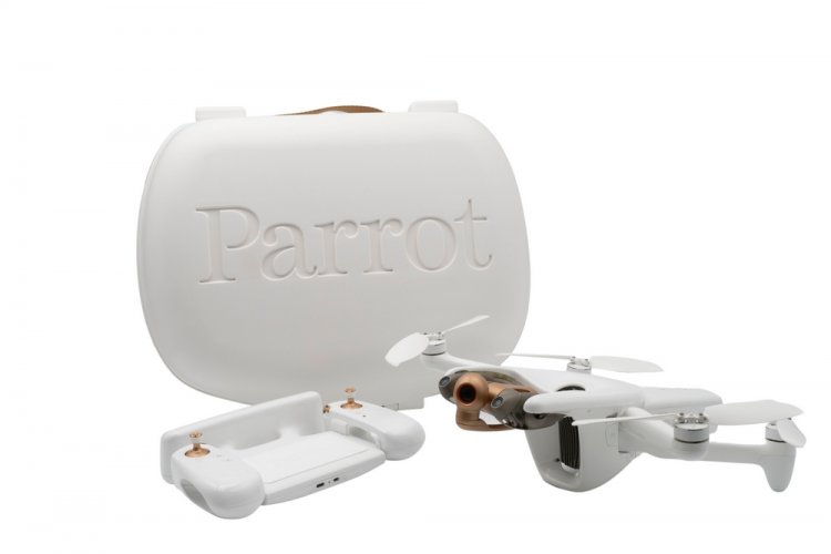
Pack Contents:
1 ANAFI Ai drone
1 hard case
1 Skycontroller 4 remote
1 smart battery
1 USB-PD (Power Delivery) fast charger
1 USB-C – Lightning cable
2 USB-C – USB-C cables
1 calibration chart
1 additional set of propeller blades
Parrot
Matériel
Parrot ANAFI Ai, ANAFI USA, Software Solutions
Construction & Real Estate, Drone Delivery, Power & Utilities, Forestry & Agriculture, Surveillance & Mapping, Leisure & Hobby, Aerial Photography, Mining & Exploration, Éducation, Security & Law Enforcement, Environment & Wildlife, Archeology & Monuments, Disaster Management / First Responders, Infrastructure & Transport, Science & Research, Autres
France, United States
DGAC (France), FAA (USA)
Parrot is today the leading group of European civilian drones. Strongly international, the Group designs, develops and markets a complementary range of micro-drone equipment and image analysis software dedicated to businesses, large groups and government organizations. At the forefront of innovation, its offer is mainly centered on 3 verticals: (i) Inspection, 3D Mapping and Geomatics, (ii) Defense and Security, and (iii) Precision Agriculture.